Early Lime Sites to the East

Unknown Date
Source: Beachville District Museum Reference Library
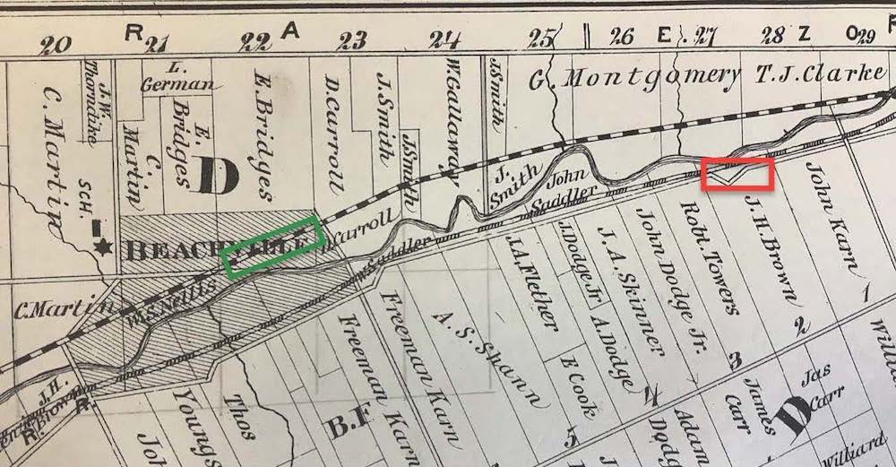
When looking at this diagram, note the river zigzagging at a diagonal and the location of the railroad (marked by a black and white band) running above the river. The river drew the dividing line between the Townships once known as “North Oxford” and “West Oxford.” You can identify each lot in North Oxford by the numbers at the top of the diagram. The lot numbers for West Oxford are visible near the bottom right corner of the diagram. The names listed in each plot are landowner names.

