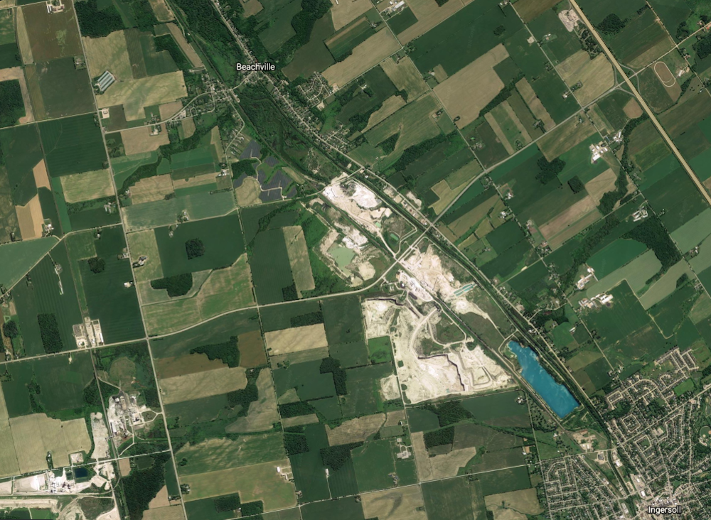
A Satellite View of the Thames River Valley Limestone Deposits

2020
Source: Google Earth
This image shows the scale of the Beachville quarries. The Village of Beachville is marked at the top (in the east), and the Town of Ingersoll is labelled in the bottom right corner (the west). The road between the two communities is called Beachville Road (County Road 9). It runs parallel to the Thames River. Chalky-coloured areas on the map represent pits that have recently been mined or are active work sites. Some tracts of land between these pits and other plots extending along the river towards the village were also excavated. They have begun to naturalize and appear green on the map. The turquoise, rectangular pool is known as “Quarry Lake.” It, too, was once a pit overseen by the Innerkip Lime and Stone and Stelco companies.

