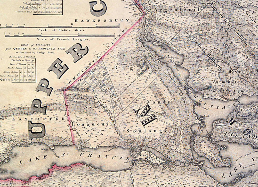
Topographic map drawn by Joseph Bouchette in 1815

© Yvon Latreille, 2010 – Musée régional de Vaudreuil-Soulanges
Details from the map of Lower Canada drawn by surveyor Joseph Bouchette (1774-1841) and published in London in 1815. We can see the territorial limits of the five seignories in which are found today’s municipalities: The île-Perrot Seignory (1672): Pincourt, L‘Île-Perrot, Notre-Dame-de-l’Île-Perrot and Terrasse-Vaudreuil; the Vaudreuil Seignory (1716): Vaudreuil-Dorion, Vaudreuil-sur-le-Lac, L’Île-Cadieux, Hudson, Saint-Lazare; the Soulanges Seignory (1716): Les Cèdres, Coteau-du-Lac, Pointe-des-Cascades and Saint-Clet; the Rigaud Seignory (1733): Rigaud, Pointe-Fortune, Très-Saint-Rédempteur, Sainte-Marthe and the Nouvelle-Longueuil Seignory (1735): Saint-Polycarpe, Saint-Télesphore, Saint-Zotique, Les Coteaux and Rivière-Beaudette, and lastly, the Newton Township. The surveyor also shows the border between Upper and Lower Canada.

