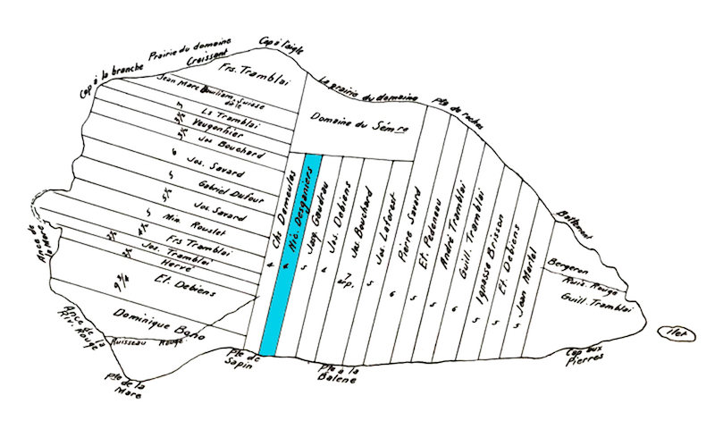
Map of Île aux Coudres

J.B. Plamondon, Plan de l’île aux Coudres en 1751
Source : collection of Bibliothèque et Archives nationales du Québec
Île aux Coudres is situated 123 kilometres northeast of Quebec City, with les Éboulements to the north and Village-des-Aulnaies to the south. This map drawn by J.B. Plamondon in 1751 shows how the land was divided. The parcel belonging to Nicolas Desgagnés is coloured blue.

