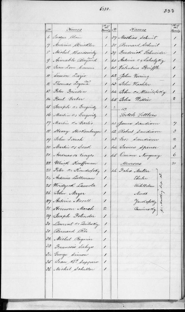
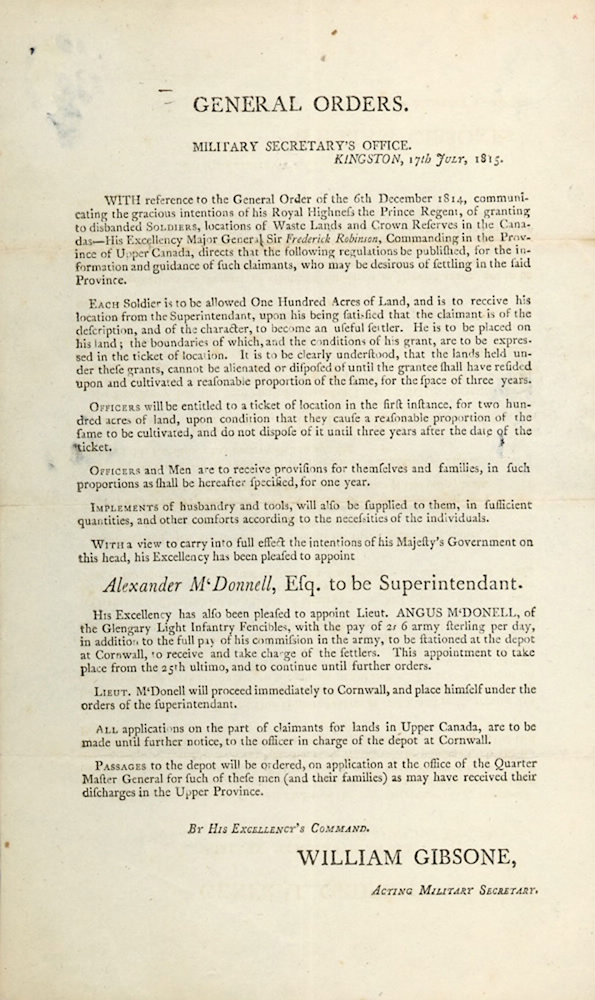
Gallery

Please browse the gallery below for the images, documents and video related to European Traces in the War of 1812. Click on an item to see an enlarged image with description or to play the video. Transcribed text is included with the document images.
Front and back of a document with details filled in by quill pen. Red wax seal at the bottom.
A black and white line drawing of several people around a hearth inside a wooden cabin.The figures include a Red River settler in discussion with a former soldier while a woman, dog and others look on.The top and bottom of the drawing are inscribed with faeded undecipherable red ink, possibly a key to the individuals in the image.
Handwitten document with signatures including pictograms of indigenous signatures.
A handwritten listing of settler names. The list is a page from lined journal and contains two columns of names. Beside each name is the number of people in each person's family. The soldiers are listed in separate groups from the Scotch settlers.
Black and white rough pencil drawing of small trees and cabins behind log fences. A rutted dirt track runs by the settlement.
A rough black and white pencil sketch of a vast flooded land. Boats and and canoes in front of flooded houses, trees and a church with steeple.
Man in a tall hat and settler's suit is leading a long-horned bullock drawing a Red River Cart. Two people are riding in the cart. A woman in a pink dress with a blue blanket/shawl and a man in a coat made from a multiistriped blanket watch as the cart passes by. The woman is wearing beaded low moccasins, a belt and bracelets. The man is wearing high moccasins and red pants.
Black and white portrait of a Saulteaux Chief.
A coloured photograph showing a tangle of snowy trees and partially frozen creek at the end of Fall.
Printed document in old type, signed by William Gibsone, Acting Military Secretary, appointing Alexander McDonnell Esq, to be Superintendent of the land distribution after the war. The document outlines supplies to be granted as well as policies for land distribution by rank.
A black and white map showing rivers, lakes, surveyed townships and roads. At top left, in a block of mixed print is written: The Perth, Lanark and Richmond SETTLEMENTS, DISTRICT OF UPPER CANADA, with part of THE ADJACENT COUNTRY
Plaque on a round stone memorial cairn. The plaque is maroon metal with gray print.
  1. Page 3 of 4
  2. 1
  3. 2
  4. 3
  5. 4