

Getting out of town
Feature image:
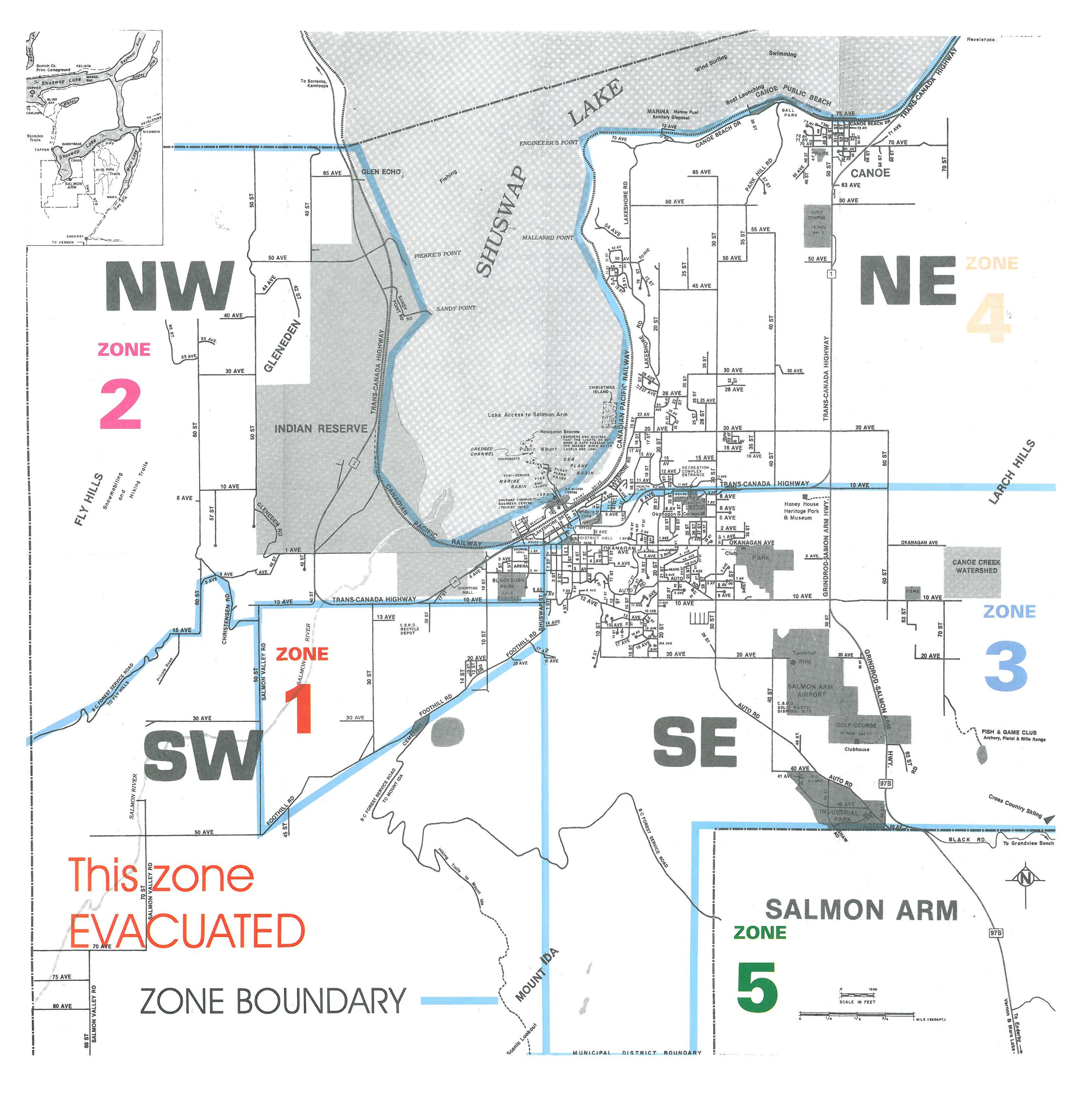
Evacuation Map showing the community of Salmon Arm divided into zones. Zone 1 was the first to evacuate. Zone 3 evacuated on August 9th.
Photo credit:
James Murray, Salmon Arm Observer, c. 1998
Premier Glen Clark called a press conference. It was a state of emergency.
Just before the evacuation residents were told to fill their tanks up with gasoline because the pumps at the filling stations were going to be turned off. Volunteers went door to door, making sure everyone knew they had to leave.
Everyone was asked to register at the community centre before leaving Salmon Arm. Red Cross Volunteers asked, “where do you plan to go?”
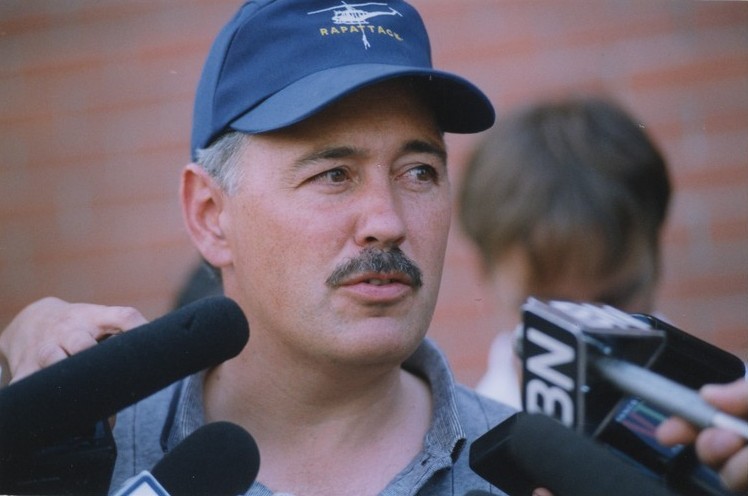
The Premier arrives.
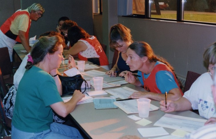
The Salmon Arm Community Centre was set up as a reception area to track the 7,000 people who were evacuated. Maureen Curtis, first Red Cross Volunteer on the scene, talks to an evacuee.