

Map by Gédéon de Catalogne, 1709
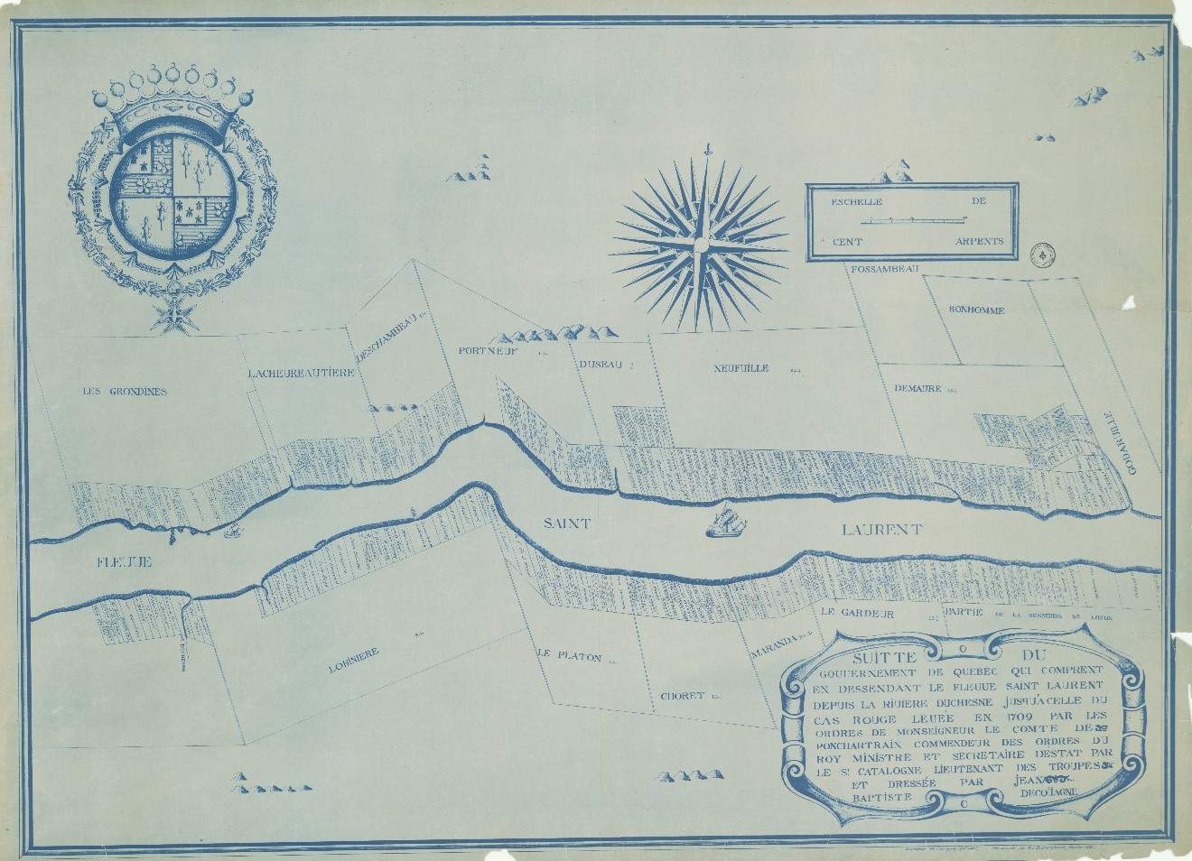
Suitte du gouvernement de Québec qui comprent en dessendant le fleuve Saint Laurent depuis la rivière Duchesne jusqu’à celle du Cas Rouge ; levée en 1709 par les ordres de Monseigneur le comte de Ponchartrain. Gédéon de Catalogne, [Québec : s.n., 1921].
Source: BAnQ (0000590360).
This map shows all the concessions of the Grondines seigneury in 1709. At the center of the parish territory is a large parcel of land in the name of Sieur Hamelin. It was on this land that the seigneurial manor house and the common mill were located.