

Map of the river from Grondines to Bastican, 1859
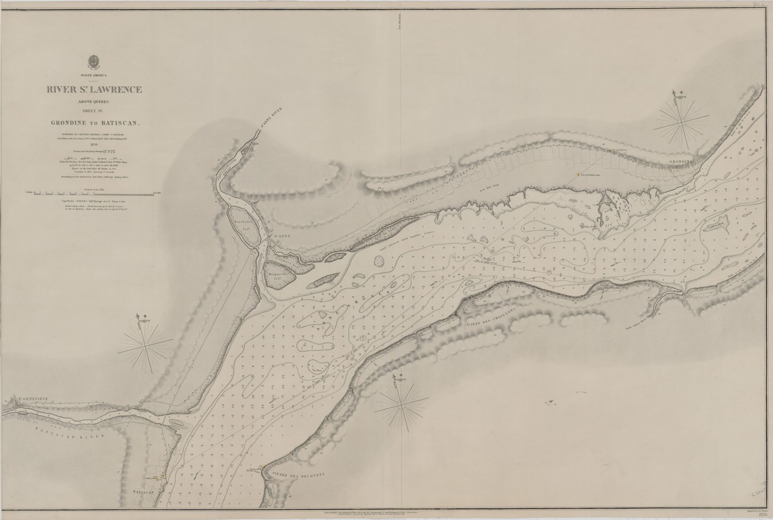
River St. Lawrence, above Quebec, sheet IV [cartographic material] : Grondine to Batiscan / surveyed by Captn. H.W. Bayfield, Commr. J. Orlebar, Lieut. Hancock, E.A. Carey, & W.T. Clifton Mastr. R.N. & Mr. Desbrisay R.N., 1859.
Source: Library and Archives Canada (R11630-2078-3-E).
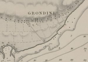
Map enlargement, Grondines area, 1859.
This map of the river, published in England on November 20, 1860, shows that the Grondines wharf to the east of the mill already existed at that time.