

Sketch of the first village hub
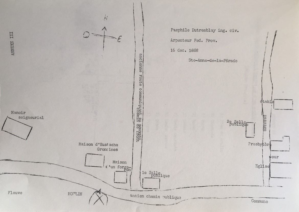
Source: Le Moulin seigneurial de Grondines, 1974, Municipalité des Grondines, Appendix 3.
Archaeological digs and the archives of Sainte-Anne-de-la-Pérade surveyor Pamphile Dutremblay, dated December 16, 1888, enabled students working for the Musée de Grondines in the early 1970s to produce a sketch of the first village settlement in Grondines.