Maps

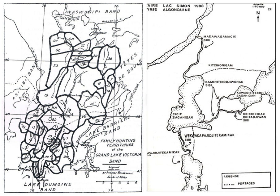
Photos credits: LEFT – Davidson, Daniel Sutherland, 1926, « The Family Hunting Territories of The Grand Lake Victoria Indians », Atti del XXII Congresso Internazionale Degli Americanisti, Vol.2. RIGHT- Corporation Archéo-08, 1989, Rapport – 1988 Intervention archéologique: Iventaire au Lac Simon (Cicip Sagahigan), p.22.
These two maps show different ways of drawing a territory, its use and its administration. They are not always accurate representations.
The one on the right shows the family hunting territories of the Grand Lac Victoria band as reported by anthropologist Daniel Sutherland Davidson in the early 20th century. It is not unanimous, but it shows that Anicinabek families occupied a large portion of territory.
The one on the left, from the late 1980s, shows Anicinabek place names. Descriptive names in Anicinabemowin provide a detailed description of the territory.

