

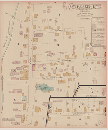
Map of Contrecœur in 1896
Goad, Chas. E. (Charles Edward) , BANQ,
http://collections.banq.qc.ca/ark:/52327/2244334
The above image shows an 1896 map of the town of Contrecœur. Only St‑Antoine Street still bears the same name. St-François Xavier Street is now Ducharme. As for Front Street, it corresponds today to Marie-Victorin Road, also known as Road 132.