The First Roads

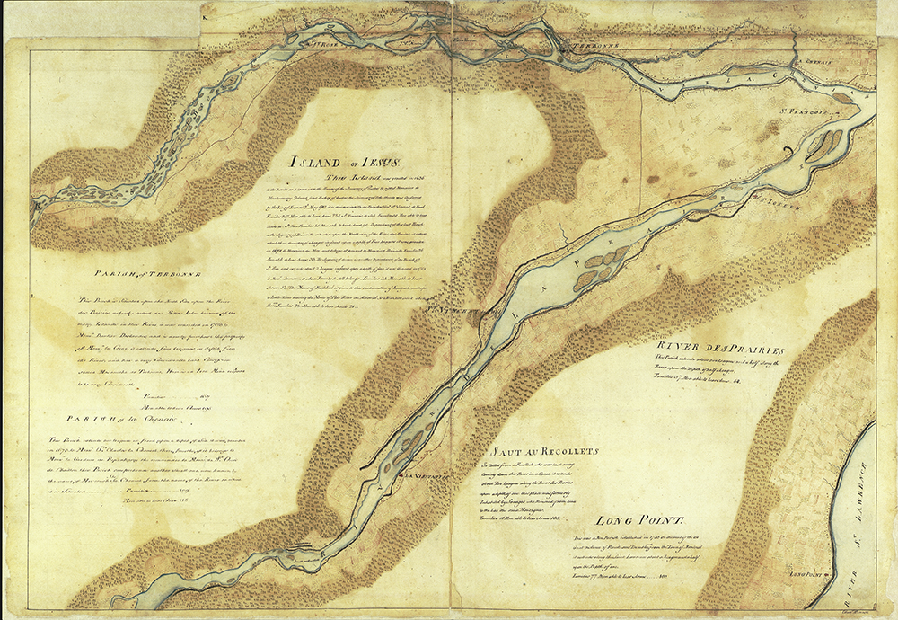
Map of the eastern portion of the “Island of Jesus” (Île Jésus), 1763
“General James Murray’s map of the St. Lawrence”
Reference: Bibliothèque et Archives Canada, A/300/[1761], NMC130543
This map produced by General James Murray between 1761 and 1763 shows the eastern end of Île Jésus and the Island of Montreal. Several dwellings can be seen along the shores, including some close to a church and a parish. From north to south, there is the Mille-Îles River, the De La Chenais River, the De La Prairie River and the St. Lawrence. You’ll notice that the spelling has undergone some changes since then!
It is also possible to see the traces of the first roads on Île Jésus: Côte du Nord and Côte du Sud. The hill that’s indicated would seem to be Montée du Moulin, given its geographic location.

