

Mapping the Lebanese Community in St. John’s, 1898-1936
Using information from St. John’s directories written between 1898-1936, we can map out where early Lebanese-Newfoundlanders lived.
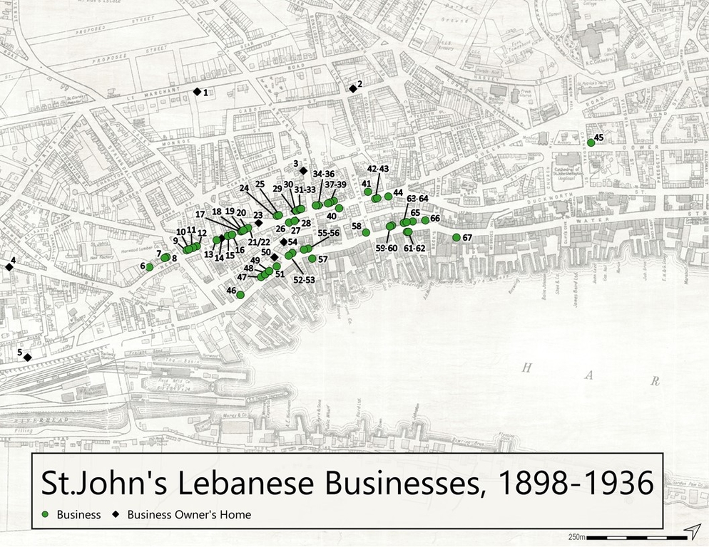
1898-1936 St. John’s Lebanese businesses and business owner’s residences.
In the 1890s, the Lebanese community was very small. Only three businesses were found at this time, including one peddler. By 1904, there were six Lebanese businesses in the city. From 1904 until about 1919, growth stayed slow, but following the end of World War I, businesses began to pop up more quickly.
While there were less Lebanese businesses during the first half of the 1900s this is not a reflection of a small population, but instead a reflection of the migration of Lebanese people through St. John’s to other communities. Families like the Kawajas, for example, were only in St. John’s briefly before moving to the west coast of the Island.
Video of 10 Newfoundland directory maps showing St. John’s Lebanese business between 1898-1936. View this video along with additional textual information (EN).
The Lebanese business community in St. John’s was mostly located in the west end of the downtown area. Most buildings were along New Gower Street and Water Street. By the 1930s, there were 43 unique businesses and 23 business owners’ homes. However, only a small number of family names were represented. These names include Tooton, Noah, Corey, Andrews, Kawaja, Boulos, Faour, Nikosey, Michael, Basha, Ellis, Murphy, Sweet, and Joseph.
In the early years, Lebanese worked as peddlers. Some ran grocery, dry goods, and confectionery stores. As the community grew, businesses expanded into hardware, jewellery, and clothing. By 1932, there was even a bowling alley and billiard hall owned by Anthony K. Noah, and a photography business owned and operated by the Tooton family.
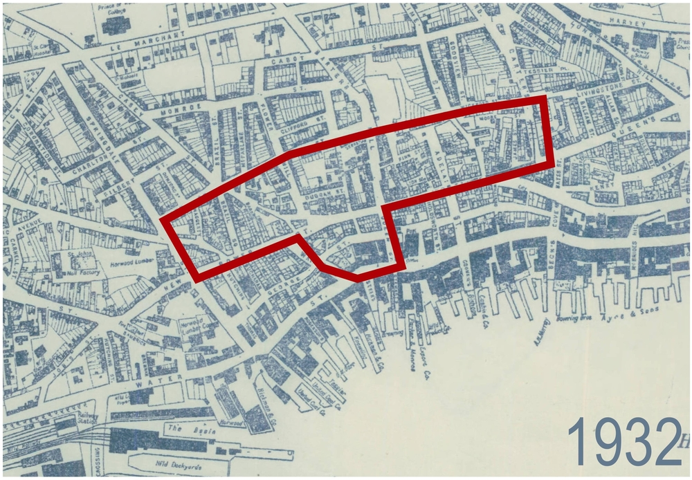
Map of St. John’s in 1932. The outlined area was redeveloped in the late 1950s into the 1960s. It includes the part of New Gower Street where Lebanese businesses developed from the late 1800s until expropriation.
While most business owners were men, some women were listed as business owners. Many more were employees. From the 1940s onwards, more women became business owners. One example was Mary Cromwell, who was born Mary (Khaltoum) Michael in 1909. Mary was a single mother of seven children, who ran a corner candy store for many years.
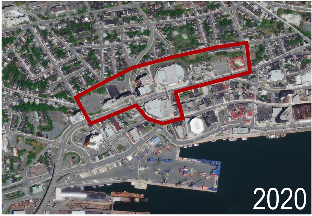
2020 aerial view of St. John’s. The red outlined area was redeveloped in the late 1950s into the 1960s. It includes the area where Lebanese businesses developed from the late 1800s until expropriation.
The Lebanese community in Newfoundland has had a long presence in St. John’s. The earliest Lebanese immigrants created a strong and prosperous sense of community in the west end that would last until the 1960s, when most people were forcibly removed from their homes on New Gower Street. The destruction of the buildings on New Gower Street has erased a great deal of the historic Lebanese built landscape.