

The site of the Seigniory of Rivière-du-Loup
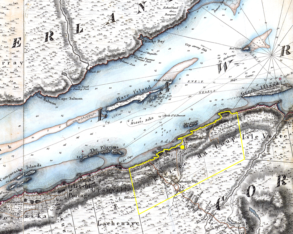
Date : 1831
Source : Detail of the topographical map of Lower Canada by Joseph Bouchette, Bibliothèque et Archives nationales du Québec, E21, S555, SS1, SSS15, P3.
Map showing the Seigniory of Rivière-du-Loup on the southern shore of the St. Lawrence River. The yellow dot indicates the location of the manors built near the Rivière du Loup.