

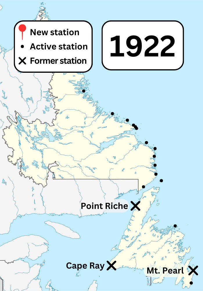
NL Wireless Stations in 1922
NordNordWest. August 28, 2009, unknown location. “Canada Newfoundland and Labrador location map.svg.” Wikimedia Commons. Edited by Admiralty House Communications Museum.
“Canada Newfoundland and Labrador location map.svg” by NordNordWest is licensed under CC BY-SA 3.0.
This map shows the locations of known Marconi stations as of 1922. It also shows the locations of closed or former Marconi stations.