

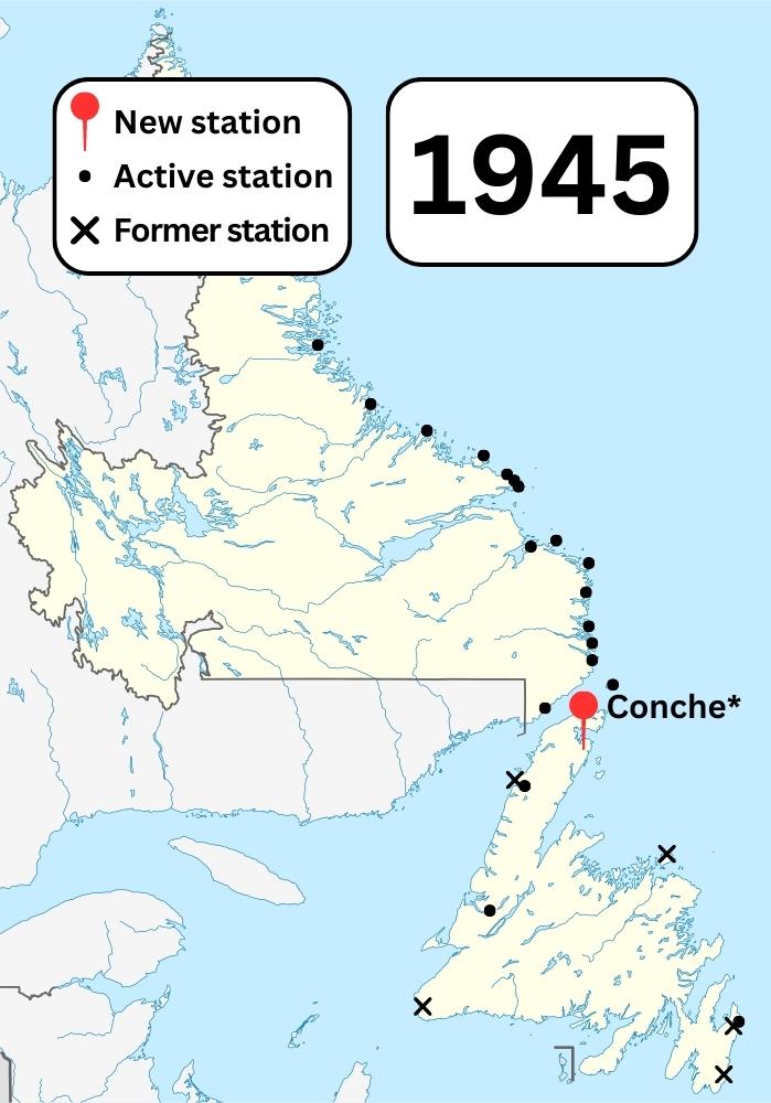
NL Wireless Stations in 1945
NordNordWest. August 28, 2009, unknown location. “Canada Newfoundland and Labrador location map.svg.” Wikimedia Commons. Edited by Admiralty House Communications Museum.
“Canada Newfoundland and Labrador location map.svg” by NordNordWest is licensed under CC BY-SA 3.0.
This map shows the locations of known Marconi stations as of 1945. It also shows the locations of closed or former Marconi stations.
Conche has an asterisk next to it as we were unable to locate the precise year the station opened. It has been included in this map based on the earliest evidence of its operation.