

Geographical location of Sault-au-Récollet in the Hochelaga archipelago (Montreal Islands)
Archives de Montréal, BM005-3-D03-P009
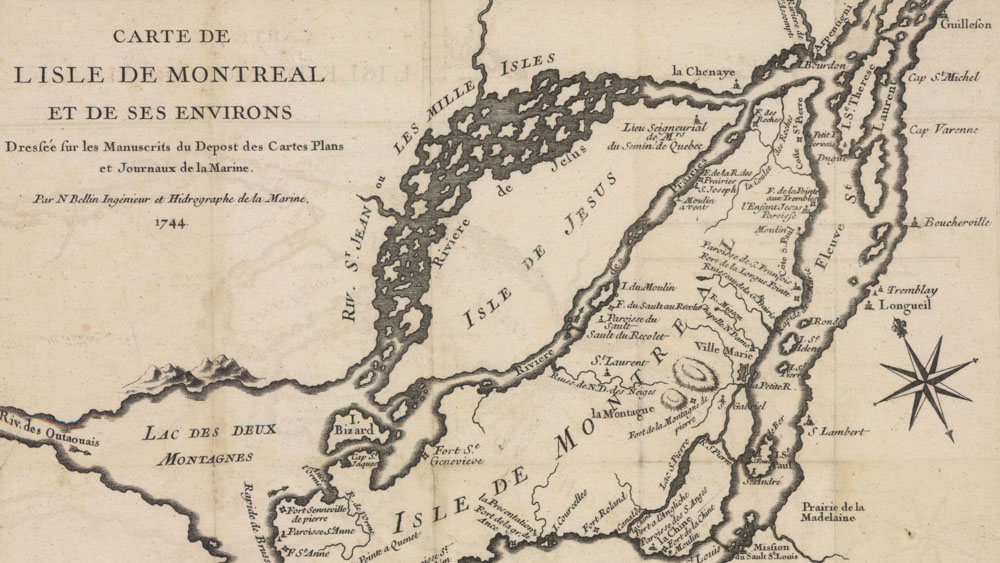
This 1744 map of the Island of Montreal and its surroundings shows the strategic position of Sault-au-Récollet at the foot of the rapids on the Des Prairies River, a major route to the Ottawa River. The village, is located at the shortest point to walk from the north of the island to Ville-Marie on the Saint-Lawrence river. Canoeing and walking were the two main modes of transportation at the time.