The Parade Route (May 15, 1872)
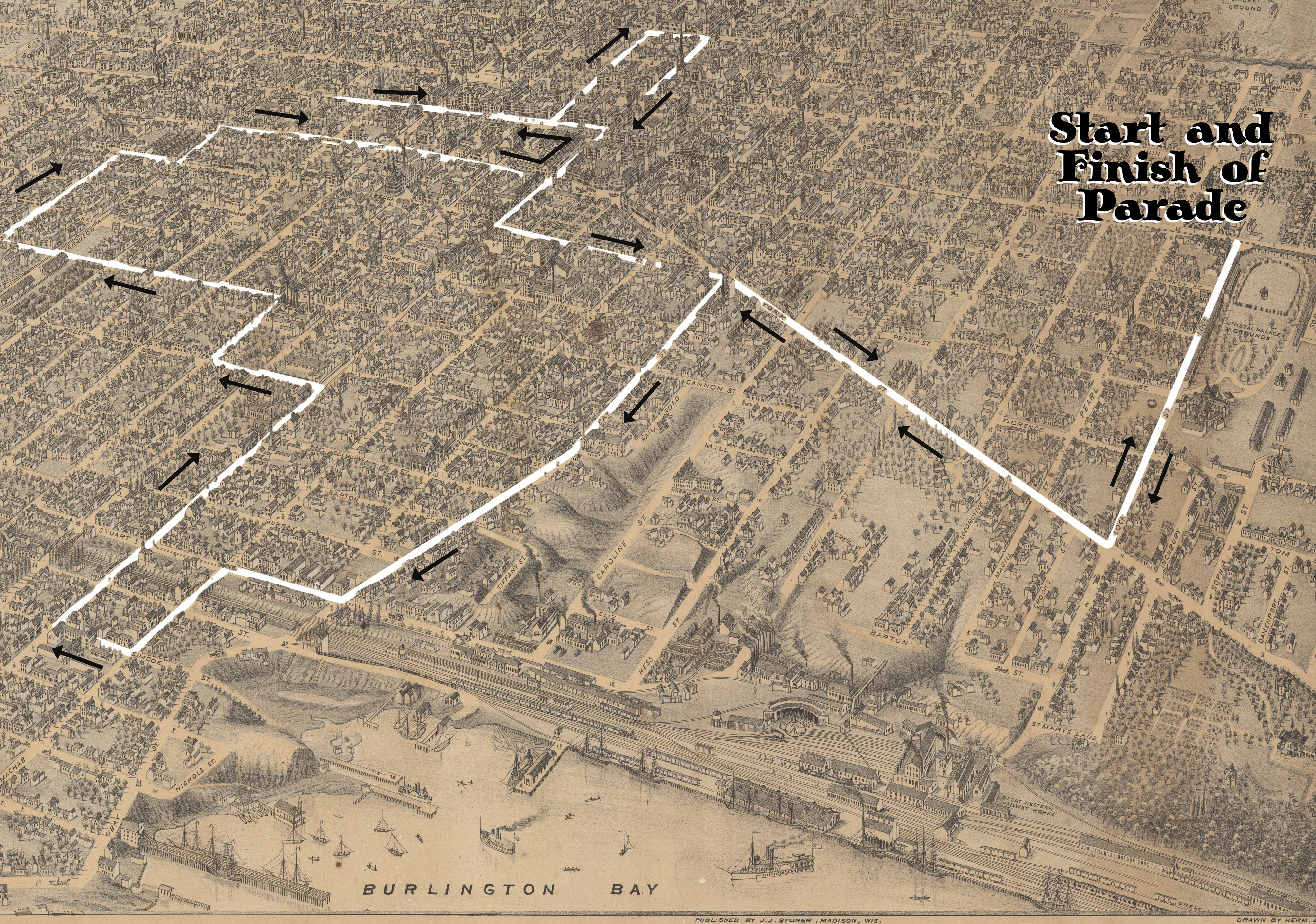
Birds Eye Map (1876), Lloyd Reed Map Collection, Mills Library, McMaster University, with additional graphics by Simon Orpana, 2016


Hamilton's Nine-Hour League and the Nine-Hour League Parade of 1872 Nine Hour League March Workers Arts and Heritage Centre
Birds Eye Map (1876), Lloyd Reed Map Collection, Mills Library, McMaster University, with additional graphics by Simon Orpana, 2016