

Aerial View of the Town of Maisonneuve, 1915
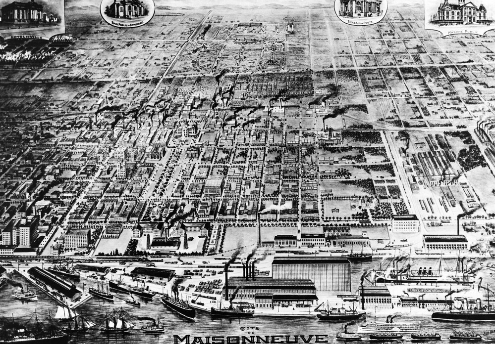
Archives de Montréal, Eugène Haberer, 1915
Uncovered in the basement of the Maisonneuve market during renovations in 1963, this drawing represents an aerial view of the town of Maisonneuve. However, this image presents a utopian version of the town. For instance, the map features a completely laid out Maisonneuve Park and a post office, two projects that never came to be due to the town’s bankruptcy.