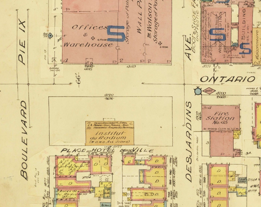
Fire Insurance Plan of the Radium Institute in Maisonneuve and its Surrounding Area, 1946

Bibliothèque et Archives nationales du Québec, Montréal Fire Insurance Plans, Vol. 6, plate 382, 1946
Part of the fire insurance plan of the area surrounding Montréal’s Radium Institute. Located at the corner of Ontario Street East and Pie-IX Boulevard, the plan includes the location of the building, along with the two annexes on Pie-IX and the duplex of the Grey Nuns, which overlooked Place Hôtel de Ville (later renamed Place Ernest-Gendreau).
Fire insurance plans were a tool used by insurance companies to calculate premiums based on the risk of fire in a given area. Such documents started to appear in Canada in the 1870s, and, of course, many were drafted for the City of Montréal. Today these maps are an essential research tool. With their clear color, crisp line, they provide a gold mine of information on old neighborhoods, complete with names of buildings and companies, the building materials used, etc.

