

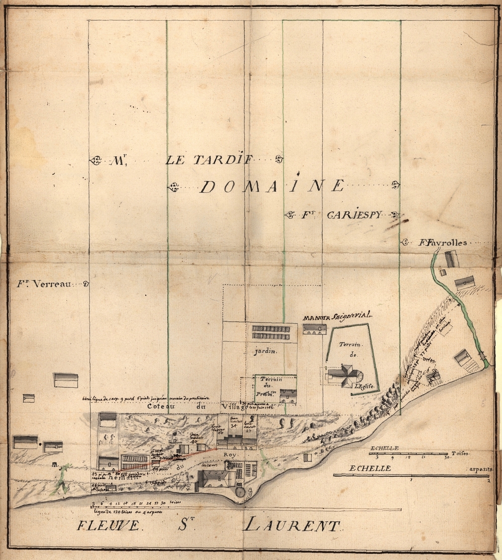
Drawing of the village of Château-Richer showing the site of the first windmill and the seigneurial domain
Source: Musée de la civilisation, fonds d’archives du Séminaire de Québec, Titres Château-Richer, No. 56
This representation of Château-Richer clearly shows the circular windmill identified by Letardif on the point of land in the lower middle part of the plan.