Laval from Above!

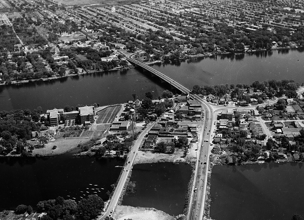
Collection of the Société d’histoire et de généalogie de l’île Jésus, C1/D3.11. Aerial photos. Office provincial de publicité, Service de ciné-photographie, circa 1960
Living on an island meant that the residents had to find ways to get around and do business with the people living nearby. As of the middle of the 19th century, a wooden bridge connected the northern part of the Island of Montreal with the district known today as Pont-Viau. The widespread theory on the origins of this name is that the land near the bridge belonged to a certain Viau. A new concrete structure was built at the start of the 20th century.
This is an aerial view of the Viau Bridge from Laval, looking toward Montreal. This photograph was taken before the Marigot [backwater] was filled in. At the bottom of the image, you can see the arm of the Des Prairies River that veers inland. The level of this stretch of water fluctuated a lot. Initially, the level was lower and in summer, the Marigot was like a swamp. After the Saint-Vincent-de-Paul dam went into service in 1930, the water level rose and people could swim in the river and dock their boats there. Around 1960, the municipality filled in this area of the shoreline to enlarge the municipal park.

