

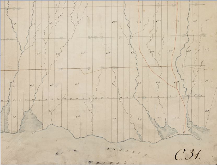
Whitby Township Plan
Source: Archives of Ontario, C277-1-433-0-2, F005149
Date: 1795
The first map of Whitby Township by Augustus Jones (1757-1836) included the location of Benjamin Wilson’s Homestead and the trail known today as the Scugog Carrying Place, drawn in red, on his survey.