

Whitby Township Plan, First and Second Marsh
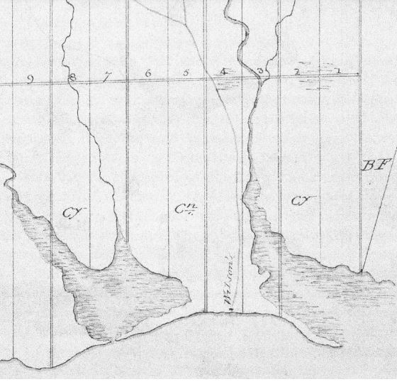
Source: Archives of Ontario, C277-2-433-0-2, F005149.
Date: 1795
Detail of Augustus Jones’s 1795 “Whitby Township Plan C31,” showing the Scugog Carrying Place Trail, the First and Second Marsh, and the location of Benjamin Wilson’s cabin (“Wilson’s”) in Lot 4.