

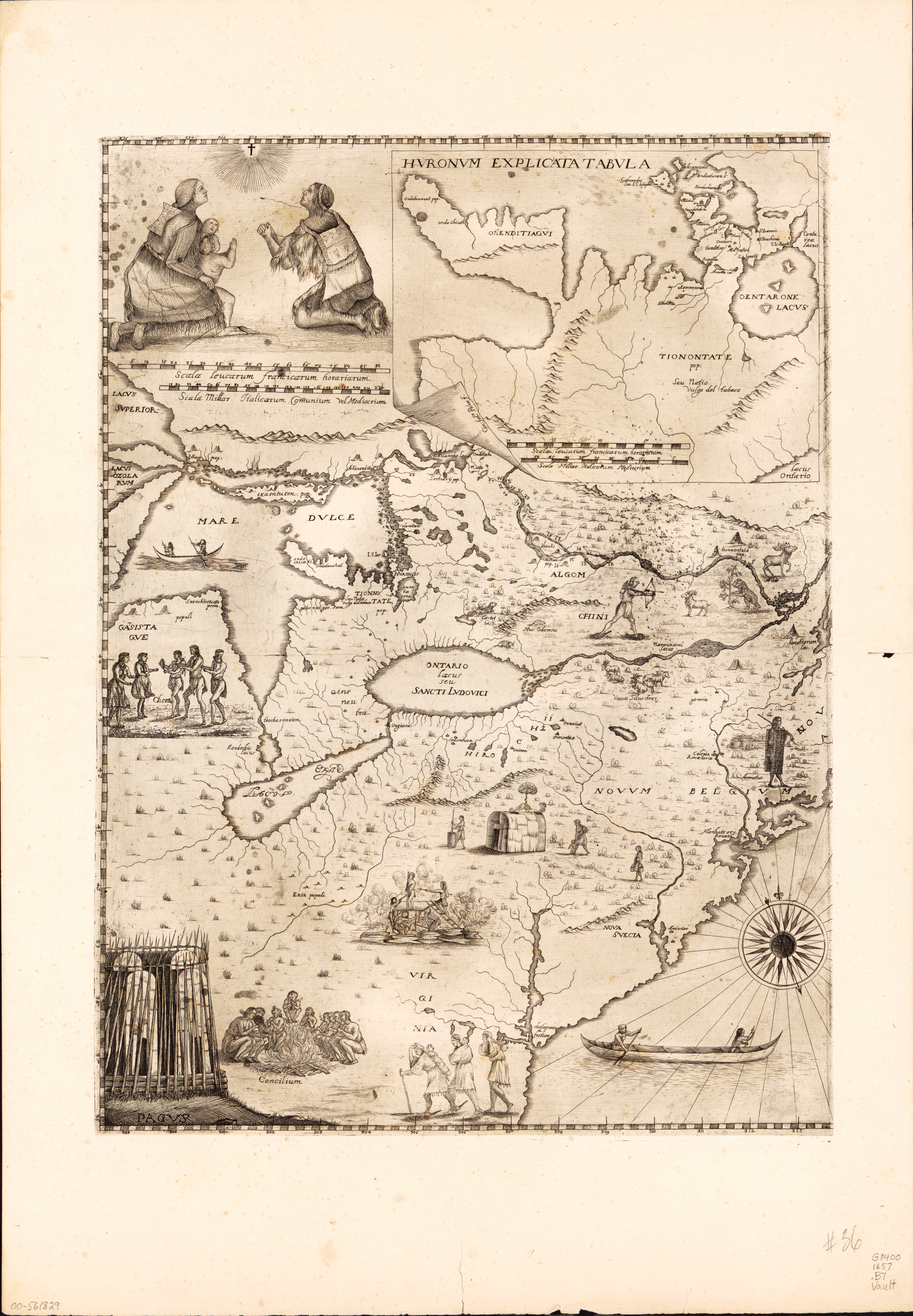
17th Century Map of North America
Library and Archives Canada
Bressani, Francesco Giuseppe. Novae Franciae accurata delineatio 1657. [Macerata, Italy?: s.n, 1657] Map.
ca. 1657
Map of North America, from Newfoundland to Lake Superior, and from the Gulf of St. Lawrence to Chesapeake Bay. A small map of Huronia is presented in a cartouche. The eastern leaf includes an engraving depicting the martyrdom of the Jesuit missionaries, including the fathers Jean de Brebeuf and Gabriel Lalemant. Engraving representing a family of Native Americans in prayer in the upper left corner of the western leaf. Several scenes representing Native Americans in various types of activities.