

A.E Jones Illustration of Early Ste. Marie I
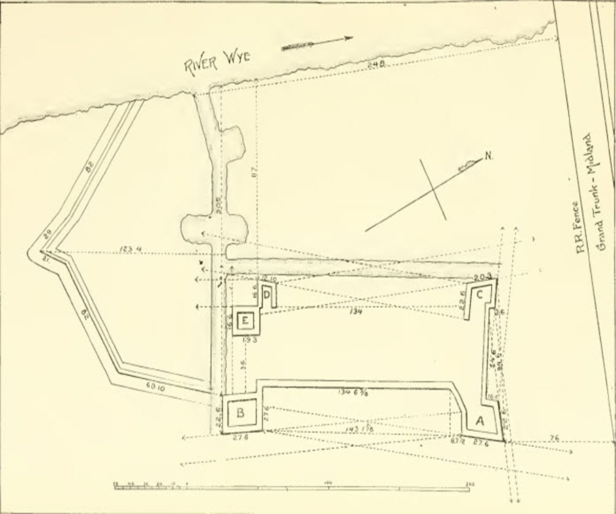
Illustration Reproduced by A.E Jones illustration of Ste. Marie I in 1908.
Date: ca. 19th century
This map is reproduced from one of the earliest understandings of the site and shows the forts situation in relation to the River Wye as drawn by Father Felix Martin around 1855.