

Weather map
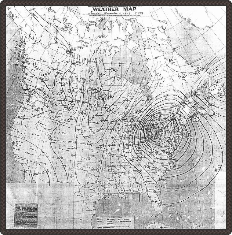
Date: November 1913
Credits: Meterological Service, Dominion of Canada
This is a weather map of the Great Storm, dated Sunday November 9, 1913, at 8:00 p.m. This was at the point when the storm was reaching its peak and was centered over Lake Huron.