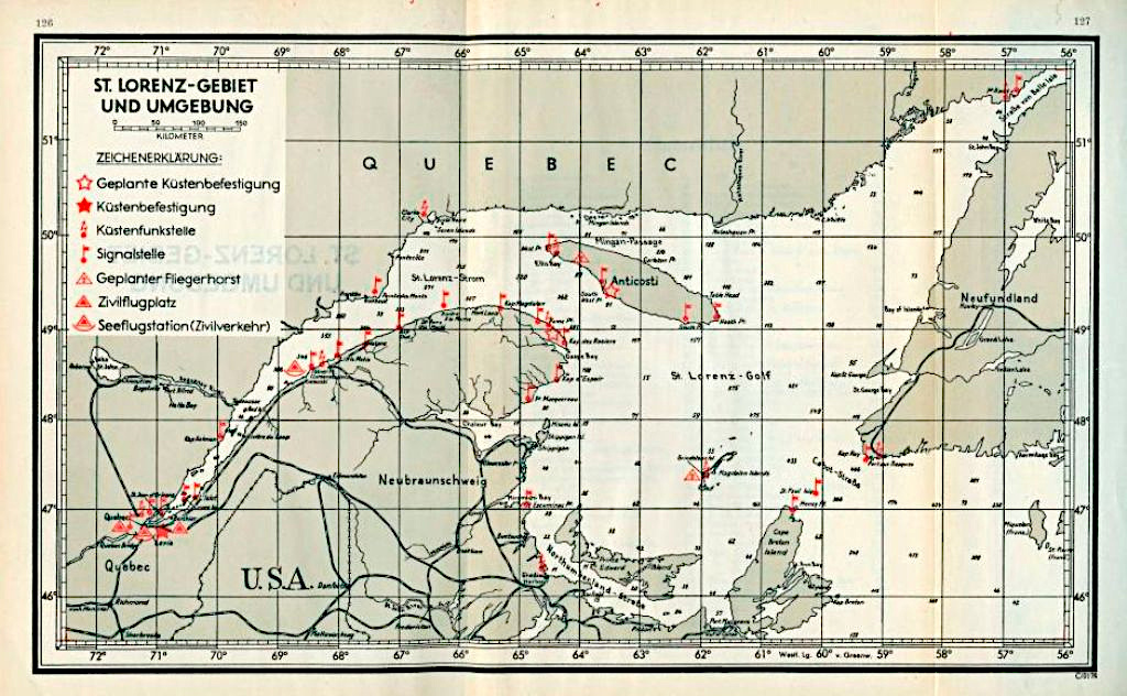
German U-boat map of the Gulf of St. Lawrence

Map:
Canadian War Museum, George Metcalf archival collection, CWM 19730174-002_b
This German Navy map provides a general overview of the River and Gulf of St. Lawrence. It was recovered from a German U-boat at the end of World War II. U-69 carried the same map when it patrolled in this area and sank S.S. Carolus and S.S. Caribou in October 1942.
The map legend at the upper left identifies locations including navigation lights and lighthouses (Signalstelle), coastal radio stations (Küstenfunkstelle) and facilities that could help a U-Boat determine its location. It also identifies threats like coastal defence batteries (Küstenbefestigung) and civilian airfields that could serve as bases for Allied military aircraft (Zivilflugplatz).

