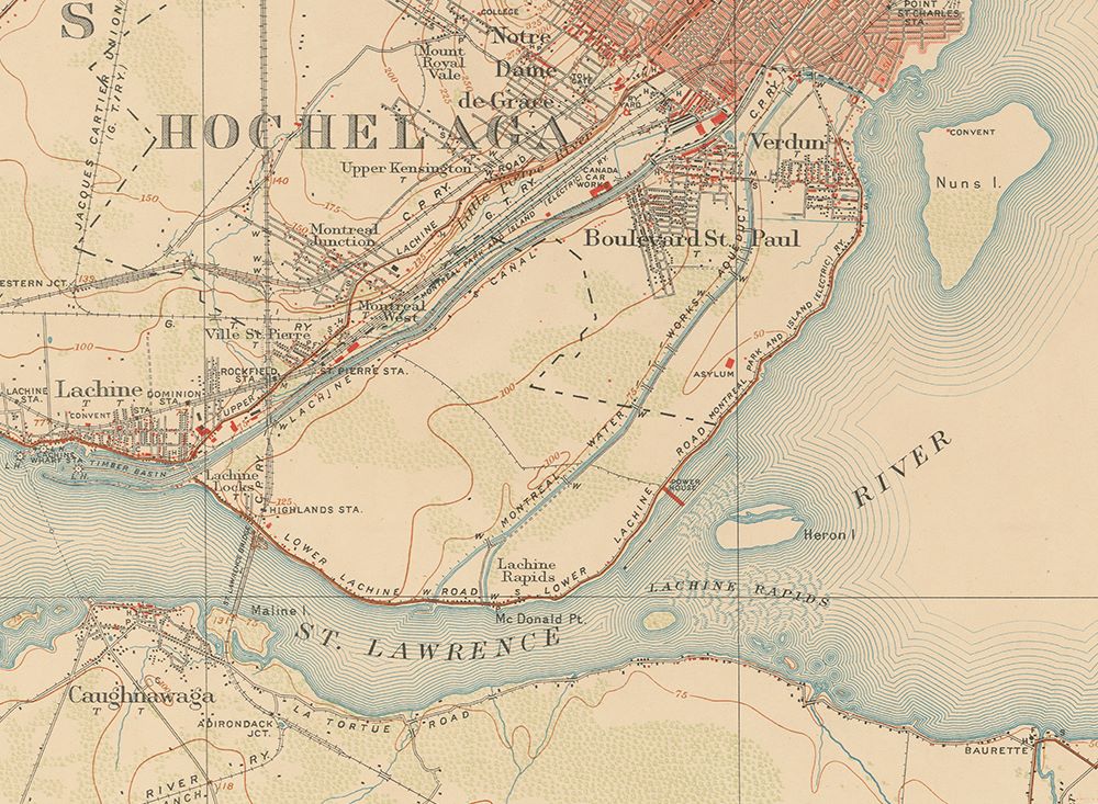
Verdun, A Territory Surrounded By Water

Date: 1909
Source: Carte topographique du Canada, 31-H-05, Lachine (partial view). Bibliothèque et Archives nationales du Québec (0002684183
This map shows the City of Verdun isolated geographically by the Aqueduct Canal and the St. Lawrence River. To the north-east, another short canal (a tail race) delimits Verdun and Pointe-Saint-Charles. This canal runs along Rivière Saint-Pierre and then empties into the St. Lawrence River.
At the time, it was difficult to enter and leave Verdun. Verdunites had to wait until 1922 for a carriage road to be built to Côte-Saint-Paul, and bus service to Montreal was only introduced in 1926.

