

The Shops in Roc-d’Or
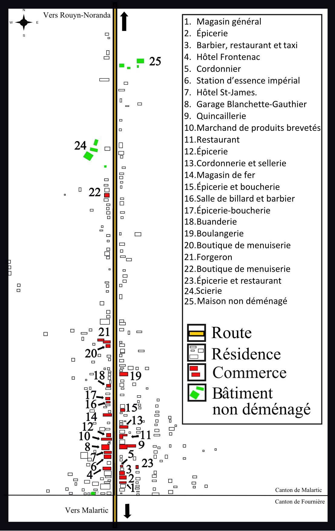
Date : 1942
Credits : Alexandre Faucher, De l’or… et des putes?, Rouyn-Noranda, Éditions du Quartz, 2014.
This map is an excerpt from “De l’or… et des putes? [Gold … and Whores?], a book by Alexandre Faucher, published in 2014. Most of Roc-d’Or’s businesses fronted the main road at the southern end of the village. This road linked the region’s two main towns, Rouyn and Val-d’Or.