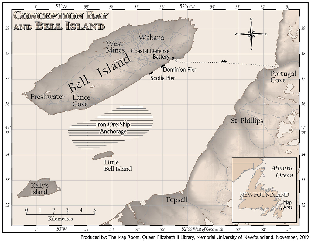
Map of Bell Island, Newfoundland in 1942 (click to enlarge)

Map: David Mercer
© The Map Room, Queen Elizabeth II Library, Memorial University of Newfoundland, 2019
Map of Bell Island in Conception Bay, Newfoundland. Bell Island is roughly 10 kilometres long by 3.5 kilometres wide, and is 5 kilometres offshore of Portugal Cove. The main town of Wabana is located in the northeast. The smaller community of Lance Cove is located on the southern shore. The iron mines are found on the northern shore. The Scotia and Dominion ore loading piers are on the shore directly south of Wabana, and just west of the ferry dock. The two coastal defence guns are located on top of the cliffs overlooking the ferry dock. The anchorage for loaded ore ships is located off the southern shore between Lance Cove and Little Bell Island. Bell Island is 20 kilometres to the west of the capital city of St. John’s.

