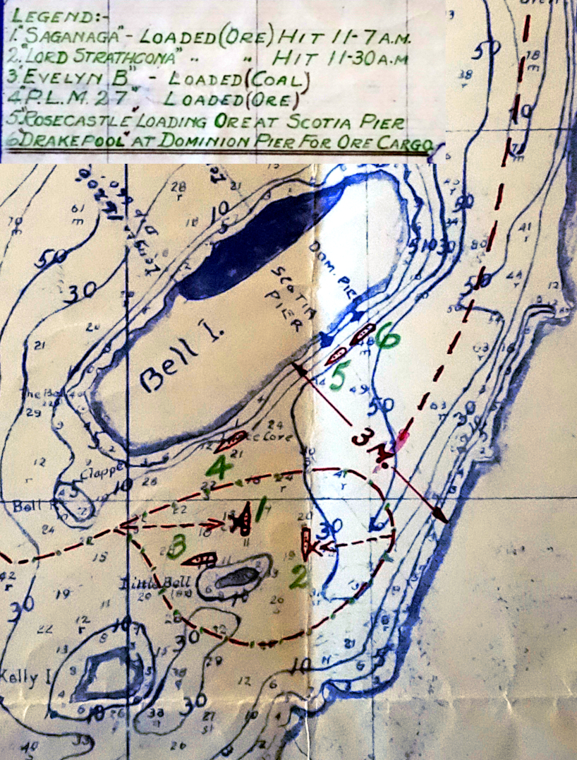
Map of first U-boat attack at Bell Island

Map:
Library and Archives Canada, Department of National Defence fonds, RG24-D-1-c, box 6890, file NSS8871-325
The Royal Canadian Navy (RCN) investigated the first U-boat attack and sinkings after September 5, 1942. This map came from RCN files on the sinking of SS Saganaga.
The map shows the location of two ships at the Bell Island loading piers (SS Rose Castle and Drakepool), and four more ships anchored south of Bell Island (Saganaga, Lord Strathcona, Evelyn B and P.L.M. 27). It also shows a possible path of the German submarine, and where it fired torpedoes that struck Saganaga and Lord Strathcona at 11:07 and 11:30 Atlantic time (11:37 and 12:00 Newfoundland time).
German records from U-513 indicate that the U-boat actually entered and left Bell Island Tickle from the northeast end.

