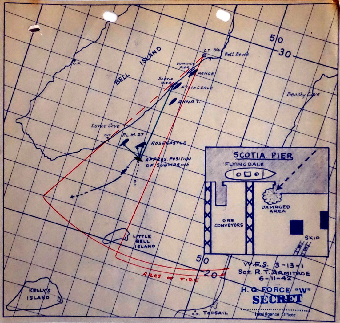
Map of second U-boat attack at Bell Island

Map:
Library and Archives Canada, Department of National Defence fonds, RG24-D-12, box 11943, file INF 1960-112/138
This map of the second U-boat attack at Bell Island was drawn by Canadian Army Intelligence staff who investigated the sinkings.
The map (marked SECRET) shows two ships at the Bell Island loading piers (SS Panos and Fylingdale), another ship (Anna T) anchored nearby, and two more ships (Rose Castle and P.L.M. 27) anchored southeast of Lance Cove. It also shows where a torpedo from the German U-boat narrowly missed the ore ships Rose Castle, Anna T and Fylingdale, and hit the Scotia loading pier. It shows the path of three other torpedoes which sank Rose Castle and P.L.M. 27. It also shows the arcs of fire of the two coastal defence guns on Bell Island. An inset map shows the location of torpedo damage on Scotia pier.
German records show that U-518 actually fired five torpedoes altogether, so one may not have exploded.

